Can't use a converted gpx layer for image correlation
What steps will reproduce the problem?
- Load some images, and a gpx track (you can use the samples from my other ticket : https://josm.openstreetmap.de/attachment/ticket/20795/samples.zip)
- Convert the gpx to a data layer, edit it then right click the layer and choose
Convert to gpx layer
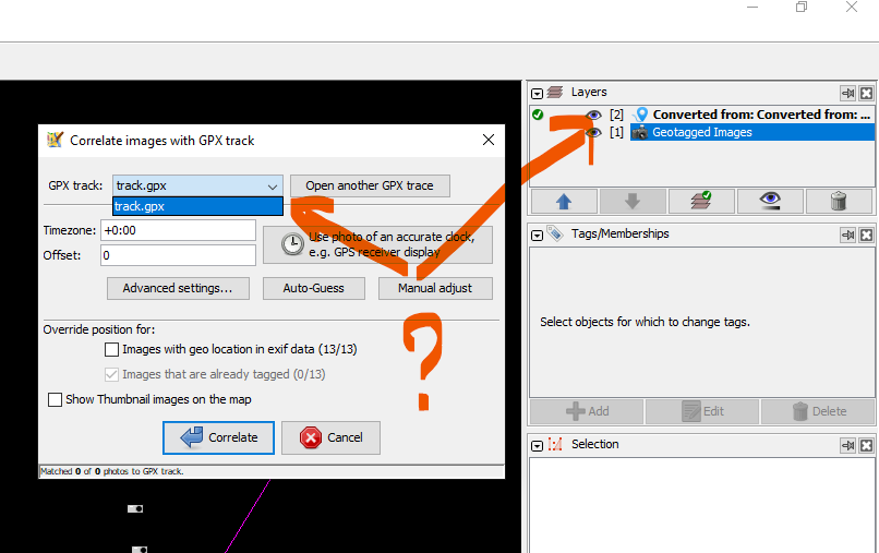
- Try to correlate the images with this new gpx
What is the expected result?
You should be able to use this new layer for correlating the images
What happens instead?
You can't choose this new layer.
URL:https://josm.openstreetmap.de/svn/trunk
Repository:UUID: 0c6e7542-c601-0410-84e7-c038aed88b3b
Last:Changed Date: 2021-04-23 21:32:22 +0200 (Fri, 23 Apr 2021)
Build-Date:2021-04-24 01:30:58
Revision:17814
Relative:URL: ^/trunk

Identification: JOSM/1.5 (17814 en) Windows 10 64-Bit
OS Build number: Windows 10 Pro 2009 (19042)
Memory Usage: 3358 MB / 7218 MB (2639 MB allocated, but free)
Java version: 1.8.0_191-b12, Oracle Corporation, Java HotSpot(TM) 64-Bit Server VM
Look and Feel: com.sun.java.swing.plaf.windows.WindowsLookAndFeel
Screen: \Display0 1920×1080 (scaling 1.00×1.00)
Maximum Screen Size: 1920×1080
Best cursor sizes: 16×16→32×32, 32×32→32×32
System property file.encoding: Cp1252
System property sun.jnu.encoding: Cp1252

Plugins:
+ Mapillary (1.5.37.6)
+ OpeningHoursEditor (35640)
+ PicLayer (2a9aa7a)
+ apache-commons (35524)
+ apache-http (35589)
+ areaselector (368)
+ austriaaddresshelper (1597341117)
+ cadastre-fr (35727)
+ continuosDownload (91)
+ contourmerge (v0.1.6)
+ ejml (35458)
+ geotools (35458)
+ javafx-windows (35655)
+ jaxb (35543)
+ jna (35662)
+ jts (35458)
+ log4j (35458)
+ opendata (35640)
+ photo_geotagging (35715)
+ photoadjust (35640)
+ reverter (35732)
+ tageditor (35640)
+ todo (30306)
+ turnlanes-tagging (288)
+ turnrestrictions (35640)
+ undelete (35640)
+ utilsplugin2 (35691)

Tagging presets:
+ %UserProfile%\Documents\Gitlab\preset-josm-collectivites\Presets-collectivités.xml

Map paint styles:
- https://josm.openstreetmap.de/josmfile?page=Styles/Enhanced_Lane_and_Road_Attributes&zip=1
- https://josm.openstreetmap.de/josmfile?page=Styles/Lane_and_Road_Attributes&zip=1
- https://raw.githubusercontent.com/species/josm-preset-traffic_sign_direction/master/direction.mapcss
- %UserProfile%\Documents\GitHub\MapCSS-JOSM-Bicycle\cycleway.mapcss

Last errors/warnings:
- 04789.270 E: Failed to locate image 'object--wire-group'
- 04789.278 E: Failed to locate image 'regulatory--dual-lanes-cyclists-and-pedestrians--g1'
- 04789.333 E: Failed to locate image 'regulatory--texts--g1'
- 04789.333 E: Failed to locate image 'regulatory--texts--g2'
- 04789.345 E: Failed to locate image 'void--car-mount'
- 04789.346 E: Failed to locate image 'void--dynamic'
- 04789.346 E: Failed to locate image 'void--ego-vehicle'
- 04789.347 E: Failed to locate image 'void--ground'
- 04789.348 E: Failed to locate image 'void--static'
- 04789.368 E: Failed to locate image 'warning--kangaroo-crossing--g1'
Change History
(7)
| Description: |
modified (diff)
|
| Component: |
Core → Core image mapping
|
| Keywords: |
correlation layer added
|
| Version: |
→ latest
|
| Resolution: |
→ duplicate
|
| Status: |
new → closed
|
| Resolution: |
duplicate → fixed
|


Closed as duplicate of #20795.
I'm closing this as duplicate of #20795 since the cause is actually the same and it will be fixed both at once