

#19892 closed defect (fixed)
The layer "Poznań: Orthophotomap Bieżąca (aerial image)" not working in JOSM but working everywhere else...
| Reported by: | anonymous | Owned by: | team |
|---|---|---|---|
| Priority: | normal | Milestone: | |
| Component: | External imagery source | Version: | tested |
| Keywords: | template_report | Cc: |
Description
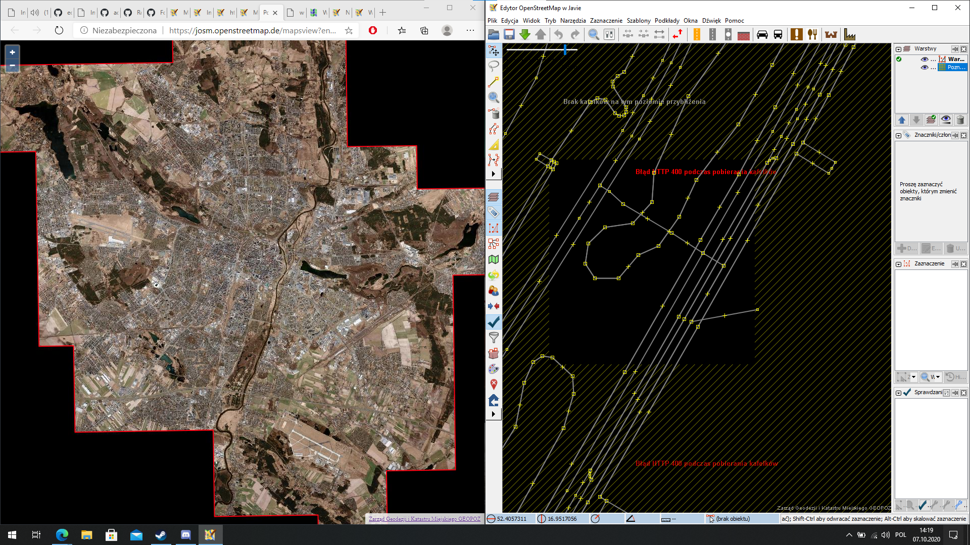
Something is extremely wrong with the layer "Poznań: Orthophotomap Bieżąca (aerial image)"https://josm.openstreetmap.de/wiki/Maps/Poland#Pozna:OrthophotomapBiecaaerialimage. You can see that its working here https://josm.openstreetmap.de/mapsview?entry=Pozna%C5%84%3A%20Orthophotomap%20Bie%C5%BC%C4%85ca%20%28aerial%20image%29 but in JOSM all I get is the error 400. This tester also confirms that the map is working https://ideditor.github.io/imagery-index/index.html just paste in there this:
{
    "type": "Feature",
    "properties": {
        "name": "Poznań: Orthophotomap Bieżąca (aerial image)",
        "type": "wms",
        "url": "http://wms2.geopoz.poznan.pl/geoserver/gwc/service/wms?LAYERS=ortogpkg:ortofotomapa_biezaca&STYLES=&FORMAT=image/jpeg&SRS={proj}&WIDTH={width}&HEIGHT={height}&BBOX={bbox}&VERSION=1.1.1&SERVICE=WMS&REQUEST=GetMap",
        "license_url": "https://www.geopoz.pl/bip/index.php?t=200&id=2449",
        "privacy_policy_url": "https://www.geopoz.pl/portal/index.php?t=200&id=5142",
        "id": "poznan-ortofotomapaBiezaca",
        "country_code": "PL",
        "best": true,
        "start_date": "2018",
        "available_projections": [
            "CRS:84",
            "EPSG:2177",
            "EPSG:2180",
            "EPSG:3857",
            "EPSG:4326"
        ],
        "attribution": {
            "text": "Zarząd Geodezji i Katastru Miejskiego GEOPOZ",
            "html": "https://www.geopoz.pl/",
            "required": true
        }
    },
"geometry": {
    "type": "Polygon",
    "coordinates": [
      [
        [
          16.72794,
          52.48838
        ],
        [
          16.86925,
          52.48982
        ],
        [
          16.86879,
          52.50779
        ],
        [
          16.93948,
          52.50845
        ],
        [
          16.93926,
          52.51743
        ],
        [
          16.98639,
          52.51784
        ],
        [
          16.98784,
          52.45494
        ],
        [
          17.03491,
          52.45534
        ],
        [
          17.0353,
          52.43736
        ],
        [
          17.08235,
          52.43774
        ],
        [
          17.0831,
          52.4018
        ],
        [
          17.0596,
          52.40161
        ],
        [
          17.06129,
          52.32075
        ],
        [
          17.01438,
          52.32035
        ],
        [
          17.01518,
          52.28441
        ],
        [
          16.96829,
          52.28401
        ],
        [
          16.96787,
          52.30198
        ],
        [
          16.89752,
          52.30134
        ],
        [
          16.89662,
          52.33728
        ],
        [
          16.80273,
          52.33638
        ],
        [
          16.80176,
          52.37232
        ],
        [
          16.77828,
          52.3721
        ],
        [
          16.77603,
          52.45294
        ],
        [
          16.72897,
          52.45244
        ],
        [
          16.72794,
          52.48838
        ]
      ]
    ]
  }
}
What steps will reproduce the problem?
- Open JOSM
- Add the mentioned layer for Poznań
- See the error HTTP 400
What is the expected result?
Not able to use the latest layer for Poznań, Poland
What happens instead?
Getting an error HTTP 400
Please provide any additional information below. Attach a screenshot if possible.
URL:https://josm.openstreetmap.de/svn/trunk
Repository:UUID: 0c6e7542-c601-0410-84e7-c038aed88b3b
Last:Changed Date: 2020-10-03 13:42:38 +0200 (Sat, 03 Oct 2020)
Build-Date:2020-10-04 01:30:47
Revision:17084
Relative:URL: ^/trunk

Identification: JOSM/1.5 (17084 pl) Windows 10 64-Bit
OS Build number: Windows 10 Education 2004 (19041)
Memory Usage: 1132 MB / 1820 MB (365 MB allocated, but free)
Java version: 1.8.0_261-b12, Oracle Corporation, Java HotSpot(TM) 64-Bit Server VM
Look and Feel: com.sun.java.swing.plaf.windows.WindowsLookAndFeel
Screen: \Display0 1920x1080 (scaling 1.0x1.0)
Maximum Screen Size: 1920x1080
Best cursor sizes: 16x16 -> 32x32, 32x32 -> 32x32
VM arguments: [-Djava.security.manager, -Djava.security.policy=file:<java.home>\lib\security\javaws.policy, -DtrustProxy=true, -Djnlpx.home=<java.home>\bin, -Djnlpx.origFilenameArg=%UserProfile%\Downloads\josm.jnlp, -Djnlpx.remove=false, -Djava.util.Arrays.useLegacyMergeSort=true, -Djnlpx.heapsize=NULL,2048m, -Djnlpx.splashport=50771, -Djnlpx.jvm=<java.home>\bin\javaw.exe]
Dataset consistency test: No problems found

Plugins:
+ PicLayer (35405)
+ indoorhelper (20bf8a3-dirty)

Map paint styles:
- <josm.pref>\styles\sit.mapcss

Last errors/warnings:
- 05251,511 W: java.net.UnknownHostException: wms2
- 05251,511 W: Already here java.net.UnknownHostException: wms2
- 05251,618 W: java.net.UnknownHostException: wms2
- 05251,620 W: java.net.UnknownHostException: wms2
- 05251,726 W: java.net.UnknownHostException: wms2
- 05251,728 W: java.net.UnknownHostException: wms2
- 05251,833 W: java.net.UnknownHostException: wms2
- 05251,835 W: java.net.UnknownHostException: wms2
- 05251,942 W: java.net.UnknownHostException: wms2
- 05251,942 E: java.net.UnknownHostException: wms2
Attachments (4)
Change History (19)
by , 4 years ago
| Attachment: | Zrzut ekranu 2020-10-07 142009.png added |
|---|
comment:1 by , 4 years ago
| Component: | Core → Core imagery |
|---|---|
| Version: | latest → tested |
comment:3 by , 4 years ago
Is there any way to set this in the layer so that everyone without this knowledge could have it working straight away? If so could you implement it, unfortunately I don't know the ropes yet
comment:4 by , 4 years ago
That error message is really interesting. Why does a WMS complain about the size of the downloaded area. Probably because this is only a cache server.
I think this should be switched either to WMTS or TMS.
comment:5 by , 4 years ago
| Component: | Core imagery → External imagery source |
|---|---|
| Resolution: | → fixed |
| Status: | new → closed |
comment:6 by , 4 years ago
| Component: | External imagery source → Core imagery |
|---|
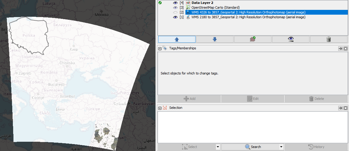
There seems to be a similar problem with the layer Geoportal 2: High Resolution Orthophotomap (aerial image) https://josm.openstreetmap.de/wiki/Maps/Poland#Geoportal2:HighResolutionOrthophotomapaerialimage, it switching it to WMTS fixes it but that also caused a desync with editor-layer-index https://github.com/osmlab/editor-layer-index
follow-up: 13 comment:7 by , 4 years ago
"Geoportal 2: High Resolution Orthophotomap (aerial image)" worked as wms in JOSM too but you needed to change the projection in your JOSM to one of the two supported ones as automatic reprojection to mercartor didn't work. I agree that wmts is better in this case as it directly works with mercator projection. Possible solutions for the desync:
- change it to wmts in ELI too (if iD supports wmts, I'm not sure about this atm)
- ignore the desync
comment:8 by , 4 years ago
| Component: | Core imagery → External imagery source |
|---|
comment:12 by , 4 years ago
Layer names should be english (for translation): https://josm.openstreetmap.de/wiki/Maps/Poland?action=diff&version=172
follow-up: 14 comment:13 by , 4 years ago
Replying to Klumbumbus:
"Geoportal 2: High Resolution Orthophotomap (aerial image)" worked as wms in JOSM too but you needed to change the projection in your JOSM to one of the two supported ones as automatic reprojection to mercartor didn't work. I agree that wmts is better in this case as it directly works with mercator projection.
Can you explain that? Reprojection is a step after the tile access. It should be independent.
comment:14 by , 4 years ago
Replying to stoecker:
Can you explain that?
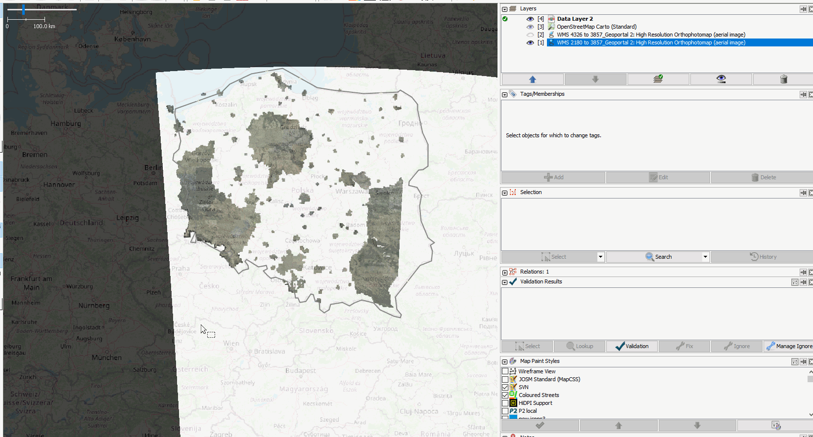
The tiles appear at the wrong place on lower zoom or get totally mixed up on each zoom step at higher zoom.
by , 4 years ago
| Attachment: | 19892a.PNG added |
|---|
by , 4 years ago
| Attachment: | 19892b.PNG added |
|---|
by , 4 years ago
| Attachment: | 19705c.gif added |
|---|
http://wms2.geopoz.poznan.pl/geoserver/gwc/service/wms?LAYERS=ortogpkg:ortofotomapa_biezaca&STYLES=&FORMAT=image/jpeg&SRS=EPSG:3857&WIDTH=512&HEIGHT=512&BBOX=0.0000000,-0.0000000,4891.9698103,4891.9698102&VERSION=1.1.1&SERVICE=WMS&REQUEST=GetMap fails with
Setting the advanced preference
imagery.wms.imageSizeto 256 resolves this issue.EDIT: You may configure the tile size via Help/Preferences/Imagery#Settings as well…