

Modify ↓
#12043 closed enhancement (fixed)
option to display/hide place fill color
| Reported by: | Klumbumbus | Owned by: | Klumbumbus |
|---|---|---|---|
| Priority: | normal | Milestone: | 15.11 |
| Component: | Internal mappaint style | Version: | |
| Keywords: | Cc: |
Description
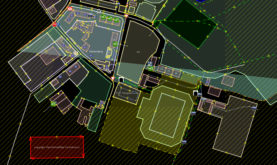
Admin boundaries are always multipolygons and use the key place=*. This leads often to confusing lines crossing the map data because of not fully loaded multipolygons. See screenshot. Furthermore it changes the fill color of other area objects and the aerial backgound imagery. There should be a mappaint setting to display/hide the place fill color.
(The mappaint style coloured streets already hides them always for better view.)
The question is if the fill color should be displayed by default or not. Any opinions?

Attachments (1)
Change History (4)
by , 9 years ago
| Attachment: | place_fill.png added |
|---|
comment:1 by , 9 years ago
| Component: | External mappaint style → Internal mappaint style |
|---|
comment:2 by , 9 years ago
| Resolution: | → fixed |
|---|---|
| Status: | new → closed |
Note:
See TracTickets
for help on using tickets.
In 8986/josm: