Improve the readability of ways
This mapstyle improves the visibility of ways (highways, waterways, buildings). Highways and waterways have colors that are more pregnant. Very handy for validators that are inspecting an area when zoomed out. Or for areas that are full of other objects.
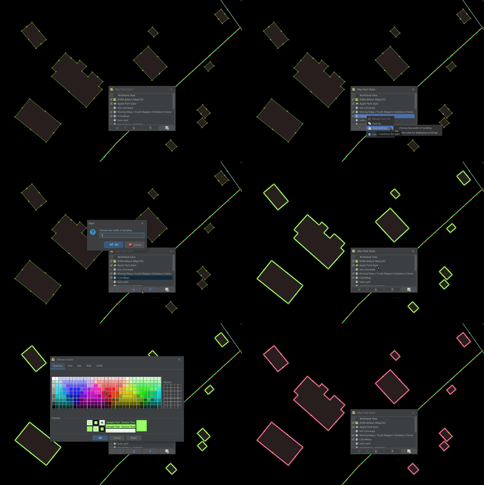
With this mapstyle you can also choose the color and the width of the outline of buildings.
It also highlights damaged/destroyed buildings. That is important for humanitarian mappers doing post-disaster mapping.
Usage and installation
- Open the Map Paint Styles preferences
- via the header of the Map Paint Styles panel with the
Preferences button or
- via View menu → Map paint styles → Map paint preferences or
- via the general preferences dialog Menu Edit → Preferences →
Map Paint Styles
- via the header of the Map Paint Styles panel with the
- Click the
plus sign on the right and enter the URL of the style file: https://josm.openstreetmap.de/josmfile?page=Styles/ColorWays&style
- Confirm by clicking the OK button (twice) and exit
See for more installation instructions: Styles
When installed you can right click on the mapstyle and choose building outline color and line width.

Legend
Highways
- unclassified → white
- track → dotted brown - green
- residential → light green - blue
- service → aqua blue
- tertiary → yellow
Railways
- railway=* → dotted brown
Waterways
- river → default
- stream → DeepSkyBlue
The code
meta {
    title: "Color Ways";
    description: "Choose your preferred color and line width of building outlines for better visibility on different backgrounds. Also highways and waterways have clearer colors";
    version: "0.2.35_2024-04-20";
    author: "Martien, osm username martien-176 (formerly martien-vdg)";
    link: "https://josm.openstreetmap.de/wiki/Styles/ColorWays";
}

/* Setting Options */

setting::colordisplay {
  type: color;
  label: tr("Color used for displaying buildings");
  default: green;
}

setting::building_line_width {
  type: double;
  label: tr("Choose line width of building");
  default: 2;
}


/* Settings */

/* Buildings */

way[building] {
    color: setting("colordisplay");
}

way[building] {
    width: setting("building_line_width");
}


/* Highways */

way[highway=primary]
{
    width: 6;
}

way[highway=secondary]
{
    width: 4;
}

way[highway=tertiary]
{
    width: 4;
}

way[highway=unclassified]
{
    width: 4;
    color: white;
}

way[highway=track]
{
    width: 4;
    color: peru;
    dashes: 12,9;
    dashes-background-color: springgreen;
}

way[highway=service]
{
    width: 3;
    color: aqua;
}

way[highway=residential]
{
    width: 2;
    color: Aquamarine;
}

/* Railways */

way[railway]
{
    width: 3;
    color: brown;
}

/* Waterways */

way[waterway=stream]
{
    width: 2;
    color: DeepSkyBlue;
}

way[waterway=river]
{
    width: 6;
}

/* Damaged buildings */

way[destroyed:building], way[damaged:building]
{
    width: 4;
    color: white;
    dashes: 12,9;
    dashes-background-color: red;

    text: eval("Damaged");
    text-color: white;
    text-halo-color: white;
    font-size: 15;
    text-position: center;
}
Styles_ColorWays-style.mapcss, Styles_ColorWays.zip
If you have questions or remarks, you can reach me via https://www.openstreetmap.org/user/martien-176


