

| Version 18 (modified by , 8 years ago) ( diff ) |
|---|
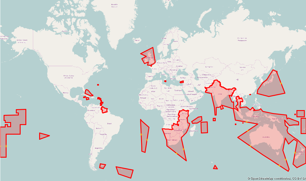
Left- and right-hand traffic
JOSM has an internal database of areas with left-hand traffic.
The database is used e.g. at the following places:
- The default internal mappaint style (for cycleway lanes and tracks on highways and roundabout icons)
- Lane and Road Attributes style
- Maxspeed style (for maxspeed:forward and maxspeed:backward)
- For the create circle action, to use the correct way direction, if you create a roundabout.
- The plugin TurnLanes-tagging
The file named "left-right-hand-traffic.osm" is stored in your JOSM cache folder. You can open this file in JOSM to investigate the borders. The areas in the file describe the areas with left-hand traffic. All other areas use right-hand traffic.
You can use the pseudo classes :righthandtraffic for right-hand traffic and !:righthandtraffic for left-hand traffic or the eval expression is_right_hand_traffic() in your mapcss mappaint style. See Help/Styles/MapCSSImplementation for more information. Note that you maybe get wrong results near to borders of countries with different driving directions since the area borders of left-hand traffic are simplified in JOSM. These simplifications are necessary to reduce the size of the database, but it can be refined on request.
If you notice an error in the database you can create a new ticket by clicking in JOSM menu Help →  Report bug.
The left-right-hand-traffic.osm file is generated from the more advanced Territories file.
Screenshot of the areas with left-hand traffic:

(data used for image ©OpenStreetMap contributors ODbL, tiles: Mapnik CC BY-SA)
Attachments (1)
- leftrighthandtraffic.png (96.6 KB ) - added by 8 years ago.
Download all attachments as: .zip