

| Version 2 (modified by , 10 years ago) ( diff ) |
|---|
[[Image(...)]] sac_scale
Description
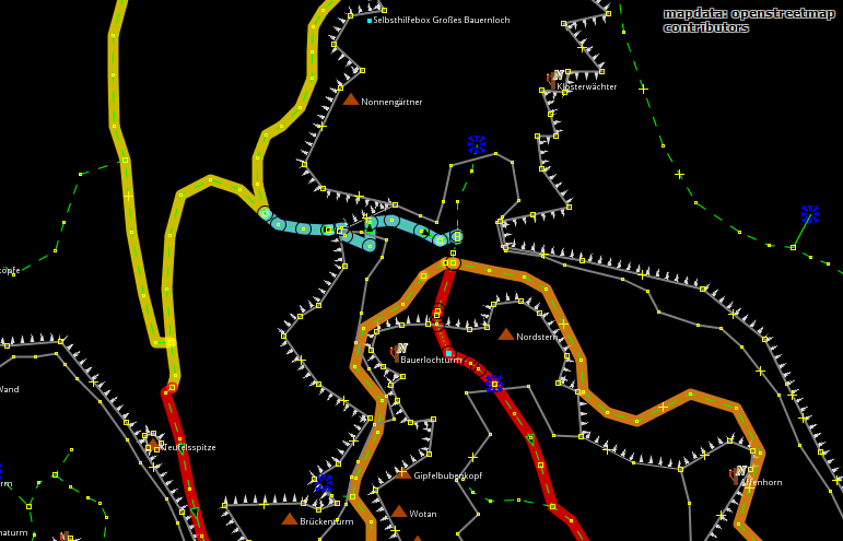
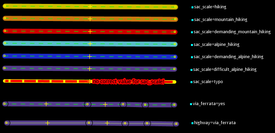
The mappaint style "sac_scale" displays the value of sac_scale coloured.
Additional it reports wrong values of sac_scale and displayes black circles for via_ferrate=yes and highway=via_ferrata. See following example screenshots.
")
")
(data used for image ©OpenStreetMap contributors ODbL)
Code
coming soon once #10521 is fixed.
Attachments (3)
-
example.png
(81.2 KB
) - added by 10 years ago.
(NOZIP)
-
legend.png
(13.0 KB
) - added by 10 years ago.
(NOZIP)
-
sac_scale_icon.svg
(4.3 KB
) - added by 10 years ago.
Icon
Download all attachments as: .zip
Note:
See TracWiki
for help on using the wiki.