

| Version 1 (modified by , 13 years ago) ( diff ) |
|---|
Languages:
- English
- français
- 日本語
- Nederlands
- русский
- українська
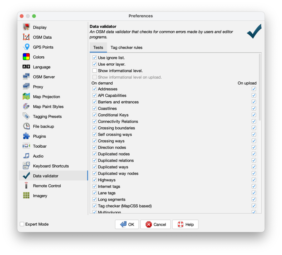
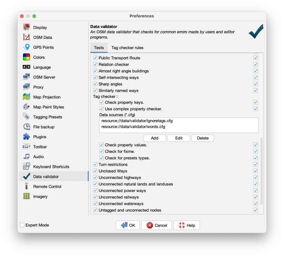
Preferences > Validator Settings
The JOSM Validator is a feature of JOSM which checks and fixes invalid data.
Usage
- Click on the new tick icon
 in the vertical toolbar to show the validator panel on the right.
- Select the data you want to validate (or deselect to validate everything)
- Click on the Validate button at the bottom of the validator panel

While some of the errors must be manually fixed, most of them can be automatically fixed. Just select the error or errors and click the Fix button to automatically fix them. You can select multiple errors, and all of them will be fixed.
The validator is an automatic test tool. It can show you errors in the data, but it may also tell you errors, which aren't real.
Don't fix errors when you aren't sure something is really wrong.
This will check the data and display all errors, categorized as errors, warnings, and other, depending on the severity of the error. By default only warnings of lever error and warning will be displayed. Warnings of lever other produce a lot more validation errors for valid data and thus need more care from the user.
Validation preferences
In this preference settings, you can activate only the tests you need. By default, all error and warning tests are active.
These are the validations performed by the validator:
| Validation | Description | How to fix | |
 | Duplicated nodes | Checks that there are no nodes in the very same location | Merge the nodes into only one, adding the properties from all nodes to the merged one |
| | Duplicated way nodes | Checks that ways contain no loop edges (i.e., a single step from a node to itself) | Split the way, and delete the way consisting of the loop edge. |
| | Reversed coastline: land not on left side | Checks for coastlines that are not counter-clockwise or that are otherwise misplaced (coastline misused as inland lake) | Reverse coastline |
| | Unconnected coastline: coastline ways do not form closed loops | Checks for coastlines ways that are not connected to the end of other coastline ways | |
| | Unordered coastline: coastline ways are not connected start-to-end | Checks for coastline ways of which either the start is not connected to the end of another coastline or the end is not connected to the start of another coastline | Reverse coastline |
| Incomplete ways | Checks for ways with zero or only one node | Removes the way |
| Check property keys | Checks misspelled property keys. See the words.cfg for file of misspelled property keys | Replace wrong key with right one | |
| Check property values | Checks misspelled property values. Uses the tagging presets file for checking | Correct spelling | |
| Empty properties | Checks for properties with empty values | Remove the empty properties | |
 | Crossing ways | Checks for ways (with highway/railway/waterway tags) that crosses in same layer with no crossing node | Add appropriate layer (and possibly bridge or tunnel) |
| Unordered ways | Checks that all segments in a way are properly ordered | Reorder the way | |
| | Overlapping (high)ways | Checks for two (high)ways that share the same nodes | Remove the double (high)way |
| | Self-intersecting ways | Check if a way crosses itself | Remove the self-crossing, remove overlapping parts or split way |
| | Similar named ways | Checks for ways with very similar names, possibly a typo | Fix names or ignore false warning |
| | Unclosed ways | Checks that way types, which should be closed really are closed | Close unclosed ways |
| | Untagged ways | Checks for untagged ways | Either describe them correctly or remove ways when useless |
| | Way end node near other highway | End point of a way is very near to other ways | Connect the ways or when really unconnected set a 'noexit' tag to prevent further warnings |
| | Style for outer way mismatches | Within a multipolygon relation, one of the tags of the relation and the outer ways is shared but with different values | Copy relation related tags to the relation itself |
| | Style for inner way equals multipolygon | Within a multipolygon relation, one of the tags of the relation and the outer ways is shared and has the same value | Remove tag from inner way |
 | FIXMES | Checks for any property with the word "FIXME" inside | Resolve the mentioned issue |
| | Highway without a reference | Checks if there is a [[Key:ref|ref tag]] for highways that are tagged tertiary. Not always required, see for instance [[NL:Map_Features#Wegen]] | Add ref property or ignore |
| | Key 'x' invalid. - ... | Check for illegal key combinations, names and similar issues | Fix the issue when possible |
| | Nodes with the same name | Check if two nodes have equal name | Join nodes when possible, ignore otherwise |
| | Overlapping areas | Checks if areas overlap | Remove overlapping only when really wrong. |
| | Unknown propery value | Checks for proper use of tags | Remove or change incorrectly used tag |
| | Untagged and unconnected nodes | Checks rogue nodes | Delete unused nodes when they have no further tags |
| | No style in multipolygon relation | The multipolygon relation is missing a tag describing what it represents | For a building, add building=yes to the relation etc. |
Back to Preferences
Back to Main Help
Attachments (3)
-
validator_settings.gif
(549.9 KB
) - added by 8 years ago.
https://github.com/mapbox/mapping/wiki/Reviewing-your-edits#customizing-error-detection https://github.com/mapbox/mapping/issues/162
-
PreferencesValidatorTests.png
(201.2 KB
) - added by 3 years ago.
new screenshot
-
PreferencesValidatorTagRules.png
(210.1 KB
) - added by 3 years ago.
new screenshot
Download all attachments as: .zip